NorthStandard has partnered with SGM Technology to give members access to PntGuard at a 15% discount, adding authenticated navigation data to its digital safety portfolio. The arrangement gives shipowners and operators another tool to detect GNSS interference and maintain reliable situational awareness onboard.
NorthStandard has partnered with SGM Technology to make PntGuard available to its members on preferential terms, targeting the operational risks created by GNSS jamming and spoofing.
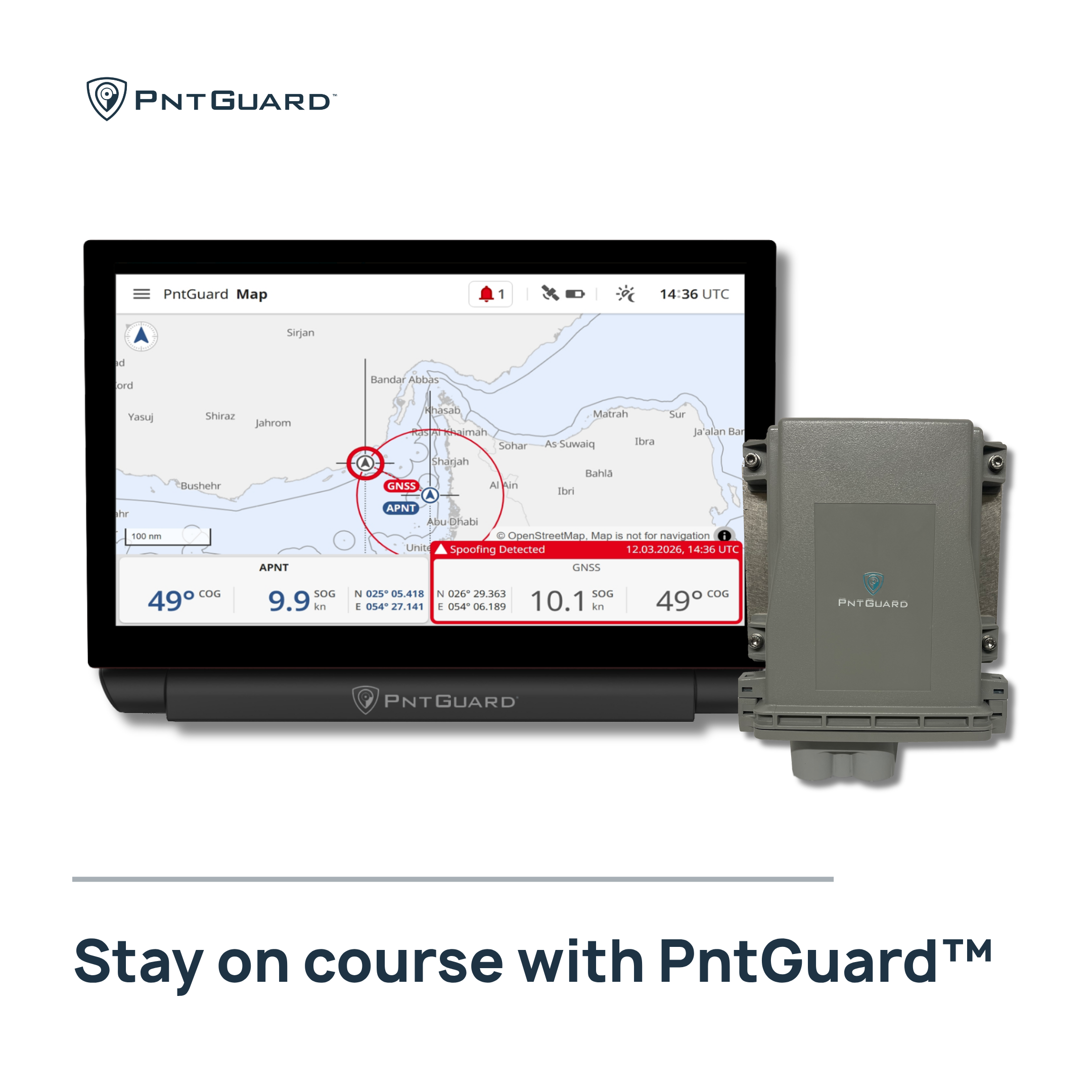
The marine insurer said members will receive a 15% discount on the PntGuard platform, which uses NAL Technologies’ assured positioning, navigation and timing technology with Iridium PNT satellite services. The system provides an independent source of authenticated ship location data when GNSS signals are disrupted.
GNSS interference can affect navigation and situational awareness onboard vessels, while unreliable navigation data can also create compliance and insurance concerns. PntGuard is designed to detect spoofing, identify jamming and provide visual and audible alerts when GNSS data fails.
The partnership adds PntGuard to NorthStandard’s GetSET! portfolio, which brings together digital tools covering vessel safety, crew skills, situational awareness and ship-shore collaboration.
Colin Gillespie, Global Head of Loss Prevention, NorthStandard, said: “NorthStandard’s strategy to assist our members to leverage the capabilities of digitalisation has already brought significant gains for voyage safety and operational decision-making. At a time when GNSS integrity is threatened as never before, PntGuard enables early warning of interference events, upholding navigational resilience and situational awareness. Its use will reduce Member exposure to navigation-related incidents.”
Alexander Wiik, Chief Commercial Officer, SGM Technology representing PntGuard, said the system compares a vessel’s GNSS feed with an authenticated signal and alerts crews when GNSS fails.
The partnership shows how maritime digitalisation is moving beyond fleet efficiency and into the reliability of the data used by bridge teams. Adding an independent navigation source gives operators another layer of information when conventional satellite signals cannot be trusted.